

GMR Property Brochure
GMR on Google Earth
Technical Reports
February 08, 2012
Red Elephant NI 43-101 Technical ReportNovember 30, 2011
Assessment Report on the Red Elephant PropertyGMR News and Reports
Jewelers Board of Trade ID #02694016
Press Release - January 06, 2020
Private Mining Company FOR SALE with 40 Grams Per Tonne Gold and 95 Ounces Per Tonne Silver
Press Release December 09, 2019
Two Gold Mines Available
Press Release - November 21, 2019
World-Class Gold Mines Seeking Collective Merger or Acquisition for Cash and Stock
Press Release - November 05, 2019
Precious Metals Private Mining Company With Over 40 G/T Gold & 43-101 Is Seeking Merger Or Acquisition For Cash & Stock
Press Release - October 02, 2013
GMR Receives Acme Laboratory Results Averaging 22.6 Grams per Tonne Gold for Rock
Samples Recovered from Red Elephant Property
See our news page for more
Search
Google for historical press releases
The mineral claim is underlain by sediments and volcanics of the Cambrian to Ordovician Eagle Bay Formation, consisting of limestones, schists and tuffs.
Mineralized quartz veins, trending southeast, occur within the volcanics and limestones. The veins carry galena and tetra- hedrite.
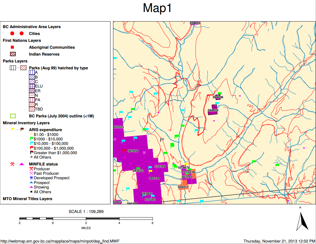
About The Red Fir (Tenure 594936)
The property is underlain by sediments and volcanics of the Eagle Bay Formation of Devonian-Mississippian age.The dominant structural trend in the area is 060 degrees with moderate (25-30 degree) dips to the northwest.
Phyllitic sediments intercalated with dolomitized and silicified carbonates are overlain by a highly pyritic chlorite schist. Separating the two units is a thin (0.5 metre) conform- able calc-silicate alteration zone.
Cutting the phyllitic sediments is a 6 by 9 metre, north-trending, quartz stockwork containing disseminations and irregular pods of galena, sphalerite and pyrite. The stockwork has a sooty black exposed surface.