

GMR Property Brochure
GMR on Google Earth
Technical Reports
February 08, 2012
Red Elephant NI 43-101 Technical ReportNovember 30, 2011
Assessment Report on the Red Elephant PropertyGMR News and Reports
Jewelers Board of Trade ID #02694016
Press Release - January 06, 2020
Private Mining Company FOR SALE with 40 Grams Per Tonne Gold and 95 Ounces Per Tonne Silver
Press Release December 09, 2019
Two Gold Mines Available
Press Release - November 21, 2019
World-Class Gold Mines Seeking Collective Merger or Acquisition for Cash and Stock
Press Release - November 05, 2019
Precious Metals Private Mining Company With Over 40 G/T Gold & 43-101 Is Seeking Merger Or Acquisition For Cash & Stock
Press Release - October 02, 2013
GMR Receives Acme Laboratory Results Averaging 22.6 Grams per Tonne Gold for Rock
Samples Recovered from Red Elephant Property
See our news page for more
Search
Google for historical press releases
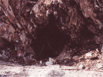
Red Elephant lower portal
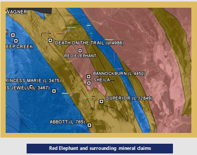
The Red Elephant is located in the Badshot Range of the Selkirk Mountains, 6.5 kilometers west of the Duncan River, on the North side of Hall Creek, approximately 125 air kilometers south of Nelson, British Columbia at an elevation of 4,600 feet. The showing is to the north and east and at lower elevation than the Bannockburn [082KNW051] and Sheila [082KNW052] properties.
1987, Mikado Resources Limited reported results for the "new" zone on the Red Elephant property. It evidently yielded chip samples that assayed 11.66, 34.01, 3.12, 5.18 and 9.50 grams per tonne gold over widths of 0.91 to 1.52 meters.
During an exploration and diamond drilling program from 1988-1990, Roper Resources Ltd. quoted an indicated resource of 26,463 tonnes grading 40.8 grams per tonne gold.
On February 8th, 2012 the NI 43-101 Technical Report on the Red Elephant Property; by Stephen B. Butrenchuk P. Geo., P. Geol. was filed with the British Columbia Securities Commission.
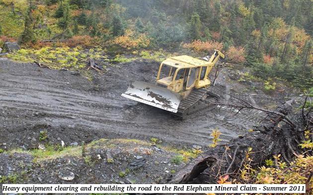
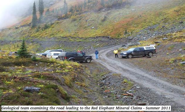
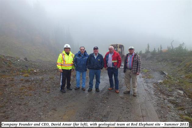
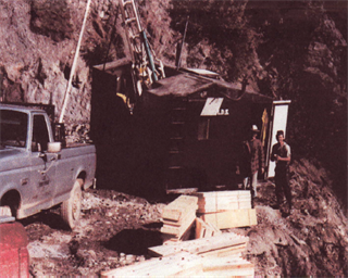
In 2011, GMR Global Mineral Resources Corp. completed an exploration and sampling program that consisted of extensive improvements, maintenance and rehabilitation on approximately 24km of Healy Creek Road leading to the property and resampling of the Red Elephant mineralized gold zone.
GMR then received assays from ACME Analytical Laboratories (Vancouver) Ltd. for samples recovered during the summer 2011 sampling program completed on the Red Elephant.
The British Columbia Ministry of Energy and Mines approved a permit to conduct further exploration and diamond drilling on the Red Elephant property:
Mines Act Permit # MX-5-90
Approval # 12-0500090-0830
Property: Red Elephant
Drilling: 4,000m
Historical Exploration
(Reported in BC MinFILE 082KNW053)In the early 1900s, an adit was driven for 16.8 meters in a northwest direction into loose, decomposed, rusty-colored schist. The tunnel was then split into three drifts for a total length of approximately 46 meters. In 1927, the then owners bonded the property to J. Morris and Associates of Spokane, who sunk a 21.3 meters deep shaft and developed about 68.6 meters of crosscut and drift. In 1929, the property was owned by H. McKay and W.J. Power.
Bannockburn Resources held the claim in 1983 and the company reported a new discovery, comprised of a 1 to 2 meter-wide band of "siliceous oxide material" the following year. In 1987, Mikado Resources Limited and Turner Energy and Resources Limited owned a large swath of country, including the Wagner [082KNW212] and Abbott [082KNW056] properties (which were their primary focus) and the Bannockburn basin showings as part of a major joint venture. A related company, Roper Resources Incorporated optioned the complete land package and, in 1988, undertook a small exploration and sampling program. Two years later, it conducted a limited diamond drill program.
The Red Elephant area is underlain by siliceous schist, phyllite and quartzite of the Marsh Adams formation, the uppermost unit of the Hamill group.
The Red Elephant adit was driven in a northwest direction into loose, decomposed, rusty-colored, schist and was then split into three drifts a short distance to the east of the so-called "lime-dyke". The workings were made to evaluate spotty high-grade gold assays encountered in a poorly defined, weakly discordant, quartz vein in an altered and highly pyritic band of schist adjacent to the limestone. The contact strikes 015 and dips at 85 degrees to the west. The vein is discontinuous and locally appears as "bunches" of quartz. It is also slightly discordant. It follows the bedding of contorted schists where they are sheared against massive limestone but generally trends slightly east of north. A sample from the middle drift, collected in 1907, gave only a trace of gold and silver, while one from the left hand drift contained "$2.40 in gold/ton" and some copper. The highest gold values were found near the portal. On surface, the vein is highly oxidized and limonitic and much of the pyrite has leached out leaving decomposed quartz with cast outlines of pyrite cubes.
A sample of partially decomposed, silicified schist and honey-combed quartz exposed in an open cut near the portal assayed 42.5 grams per tonne gold. The depth of oxidation is unknown. In 1927, it was found to extend for at least 21 meters to the base of the shaft.
In 1984, Bannockburn Resources Limited reported a new discovery, comprised of a 1 to 2 meter-wide band of "siliceous oxide material" which has been traced on strike for 130 meters. Locally, the band displays a honeycomb texture. It has produced assays of up to 43.2 grams per tonne gold.
The band is subparallel to, and approximately 100 meters south of, the main vein. At that time, it was reported to have produced assays of between 12.3 and 61.7 grams per tonne gold over 0.1 meter. In 1987, Mikado Resources Limited reported results for the "new" zone on the Red Elephant property. It evidently yielded chip samples that assayed 11.66, 34.01, 3.12, 5.18 and 9.50 grams per tonne gold over widths of 0.91 to 1.52 meters.
The following year, Roper Resources Limited quoted an indicated resource of 26,463 tonnes grading 40.8 grams per tonne gold, 36.3 grams per tonne silver and 0.93 per cent copper (George Cross News Letter 14/12/88). In 1989, the company reported a trench sample that assayed 20.6 grams per tonne gold and 3.3 per cent copper over 1.5 meters.
Picture Gallery